


A potentially dangerous fire threat is unfolding across the Plains as warm temperatures and strong wind gusts combine with a very dry landscape through Wednesday.
These conditions are developing in a region that is already experiencing a drought with the lack of recent rain and snow, leaving vegetation primed to burn.
FLORIDA FIRE DANGER SPIKES AS ‘EXTREME DROUGHT’ REACHES 25-YEAR HIGH, AS STATE OF EMERGENCY DECLARED
Kansas Governor Laura Kelly declared a State of Emergency on Sunday ahead of the extreme fire weather that is expected to also impact Colorado and Nebraska.
The dangerous weather threat is being caused by the breakdown of a strong upper-level ridge, which is allowing a series of disturbances to move across the region.
As the disturbance passes through, winds will increase. Wind gusts reached 40 to 50 mph by Monday evening.
While the winds increase, humidity will drop in some areas to around 10%.
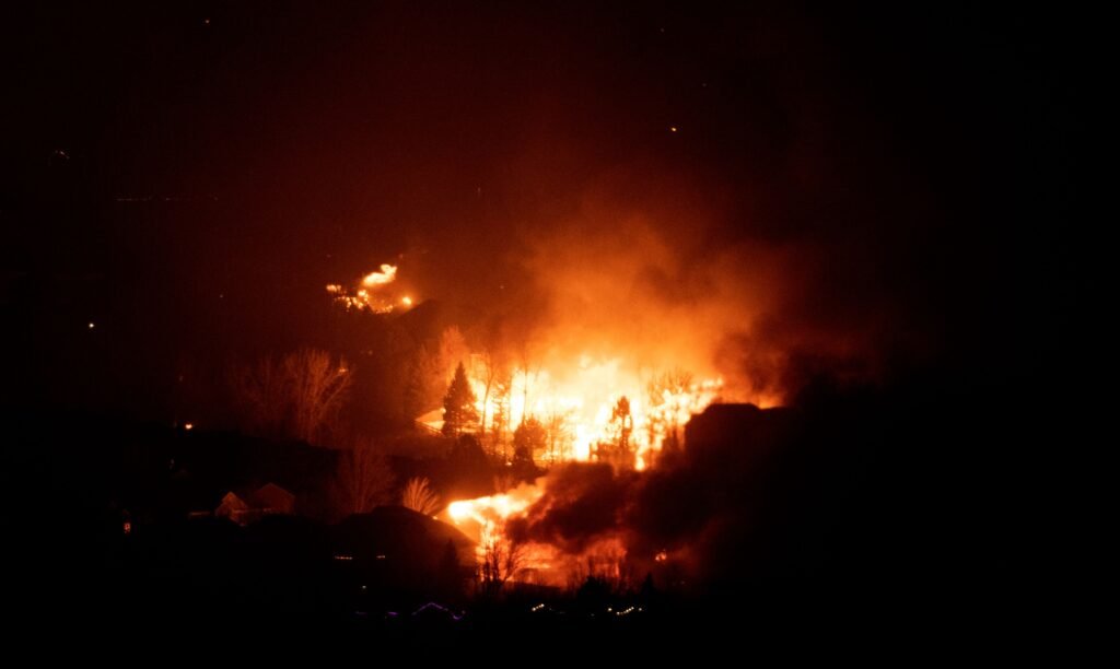
By Tuesday, conditions are expected to worsen as strong winds develop. Some areas may see wind gusts up to 70 mph. This will increase the chances of a potential rapid wildfire to spread.
According to FOX Forecast Center, when the gusty winds combine with the dry air, dormant grass and brush will become highly combustible. Any fire that starts could spread rapidly and become very difficult to contain.
In addition to the fire risk, the high winds will likely create travel and infrastructure issues across the central corridor. Blowing dust may significantly reduce visibility along major interstates including I-70 and I-80, causing a hazardous environment for driving.
LIVE UPDATES: CALIFORNIA SLAMMED BY ‘DANGEROUS’ STORM, 8 FEET OF SNOW AND LIFE-THREATENING FLOODS
By later in the week, a cold front will move through the Plains, bringing cooler temperatures and some precipitation. This should provide some relief, but until then, the Central Plains will remain at high risk of wildfires.