






NEWYou can now listen to Fox News articles!
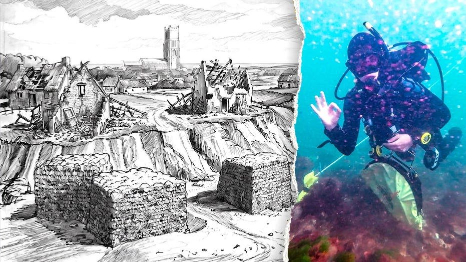
Divers recently captured the first-known images of mysterious underwater structures believed to be remnants of a village swallowed by the sea some 700 years ago.
The images and video were recently taken off the coast of Norfolk in the United Kingdom, as news agency Jam Press reported.
The remains are believed to be the lost town of Shipden, a medieval settlement that was eventually consumed by the North Sea in the 14th century.
MYSTERIOUS SETTLEMENT DISCOVERED AFTER RESIDENTS SEEMINGLY PACKED UP AND VANISHED
At the site, divers photographed and mapped 25 man-made features.
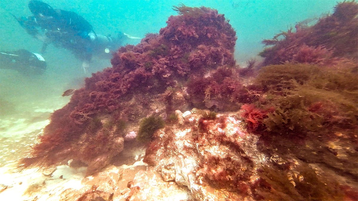
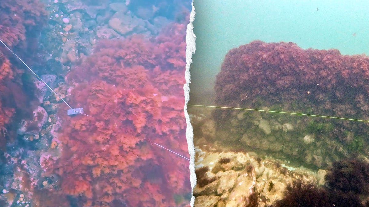
Pictures show massive, marine-covered stone structures jutting from the sandy seabed as divers explored the centuries-old site.
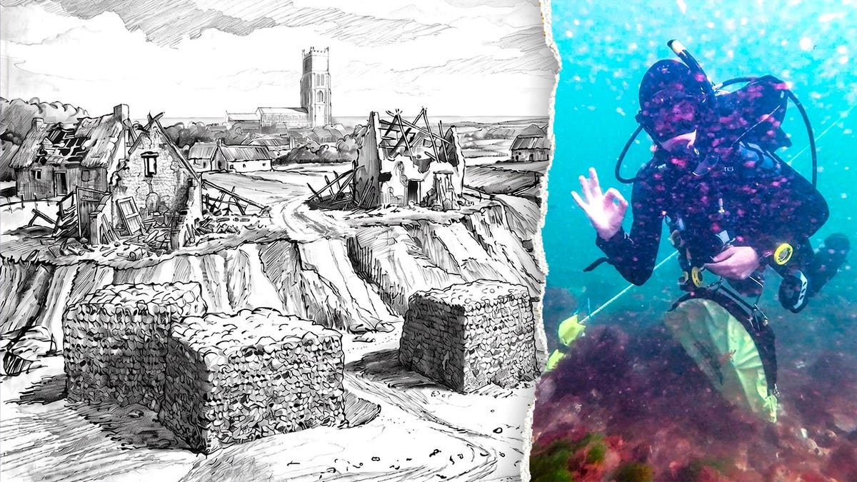
Volunteer divers from the East Anglian branch of the British Sub-Aqua Club (BSAC) helped survey and map the underwater site as part of the Alfred Savin Project’s investigation.
Despite the North Sea’s reputation for rough and dangerous conditions, the water was unusually still during the summer dives — which helped the team photograph and map features on the seabed.
FAINT SIGNAL LEADS TREASURE HUNTERS TO MASSIVE DISCOVERY AT LEGENDARY 400-YEAR-OLD WRECK
The divers found structures made of flint — a popular building material in medieval Norfolk — as well as other pieces of cut stone and the remains of stone foundation structures known as caissons.
The caissons may have been part of a 14th-century attempt to hold back the sea, but researchers have yet to determine their exact purpose.
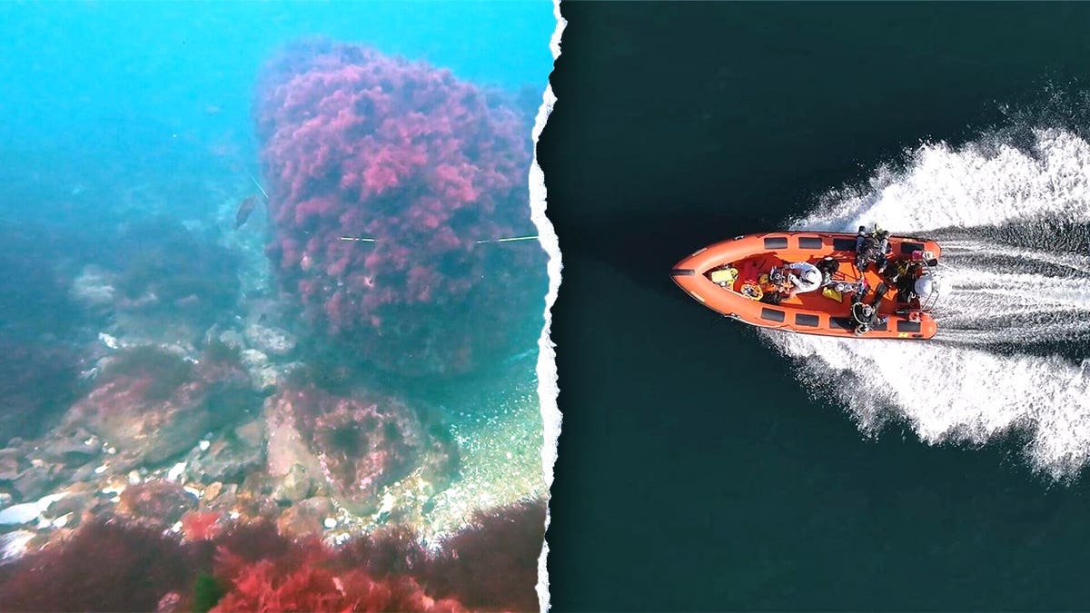
Some structures remain eight to 10 layers of stone high despite spending centuries underwater.
The effort marks the first time the features are believed to have been photographed.
UNDERWATER ROBOTICS EXPERT REVEALS ‘SHIPWRECK CITY’ HIDING BENEATH MAJOR URBAN LAKE
Once a thriving village, Shipden was home to a modest population in the High Middle Ages.
The Domesday Book — the survey that recorded land and populations across England following the Norman Conquest — noted that Shipden had just 117 residents in 1086.
The town also boasted three acres of meadow, a harbor, two churches and “woodland capable of supporting 36 pigs,” Jam Press noted.
By the 14th century, its name gradually disappeared from records and the area became known as Cromer.
CLICK HERE TO SIGN UP FOR OUR LIFESTYLE NEWSLETTER
Historical records confirm that a church was lost to the sea, but divers have yet to find any remains that can be definitively identified as the building.
Legend holds that the tower of St. Peter’s Church survived beneath the waves on a formation known as Church Rock.
“For the present, we’re putting forward ideas rather than conclusions.”
Lead diver Nick Schiller told Jam Press the team initially set out to search for additional remains of the Victoria, a vessel that wrecked on Church Rock in 1888.
“However, it’s been a bonus to help the Cromer team to take some steps forward in understanding the town of Shipden and the port of Cromer,” said Schiller.
CLICK HERE FOR MORE LIFESTYLE NEWS
He said the findings suggest that Church Rock, long believed to be connected to the lost church, may instead be the remains of medieval sea defenses.
For now, the location of the church remains a mystery.
TEST YOURSELF WITH OUR LATEST LIFESTYLE QUIZ
Looking ahead, Peter Stibbons, chair of the Friends of Cromer Museum and director of the project, said researchers are examining medieval records alongside the physical discoveries to gain a better understanding of the area.
“Those of us brought up in Cromer have always known the story of Church Rock, so it’s a big step to saying the legend may be incorrect,” Stibbons told Jam Press.
CLICK HERE TO DOWNLOAD THE FOX NEWS APP
He added, “For the present, we’re putting forward ideas rather than conclusions.”