Skip to content


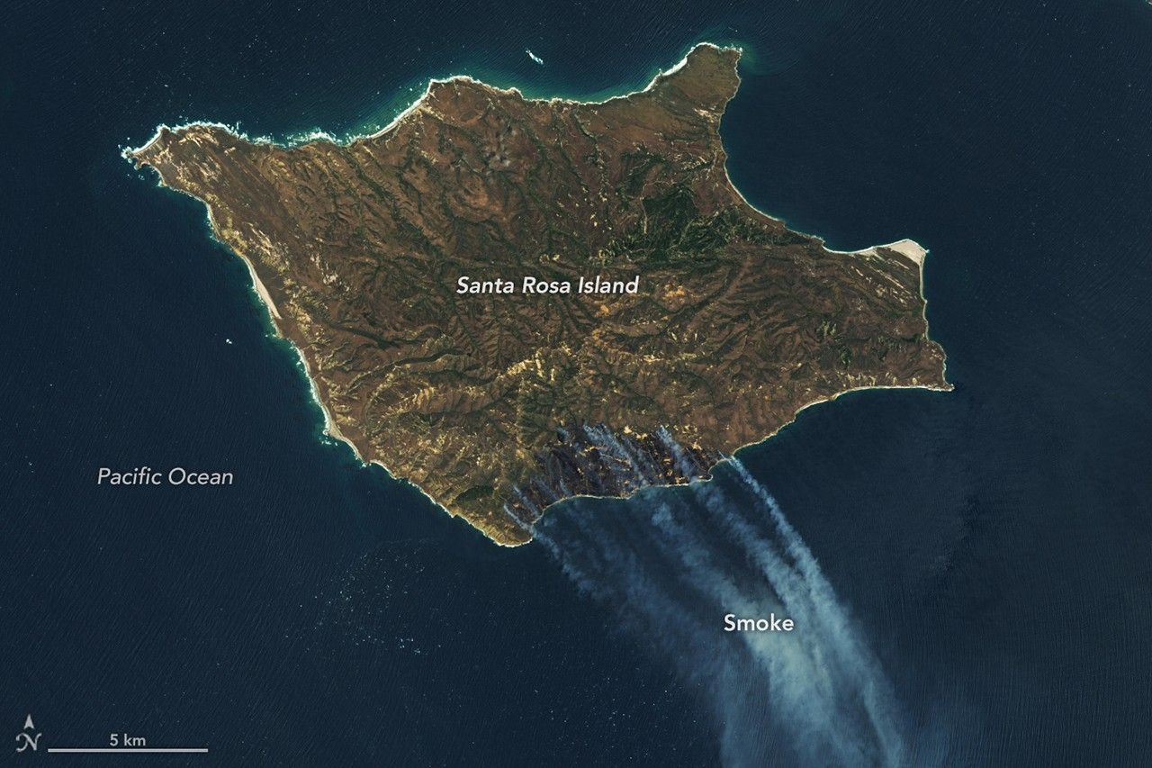
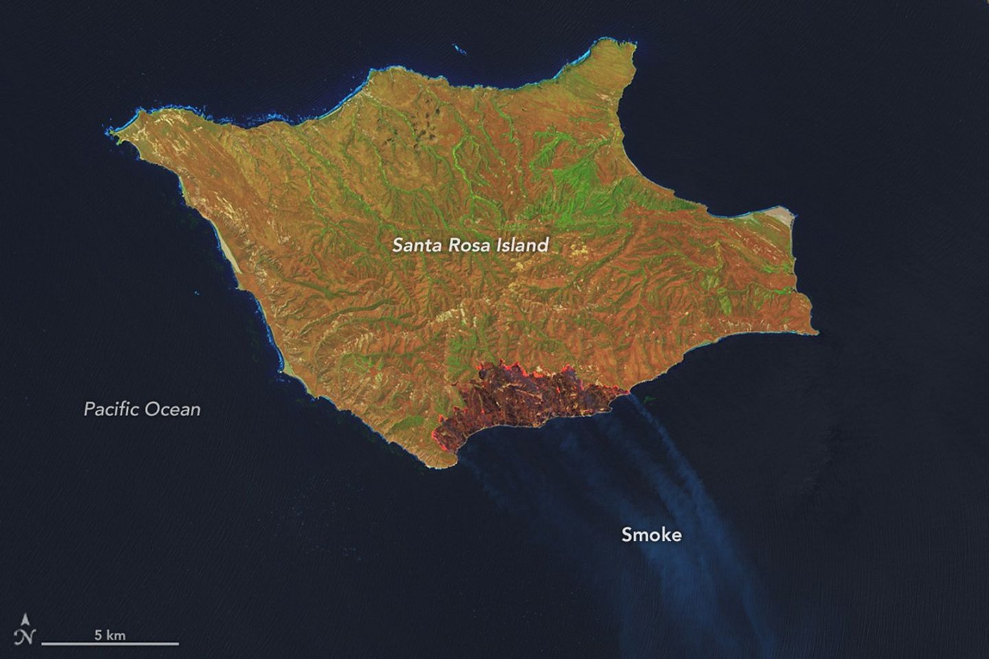

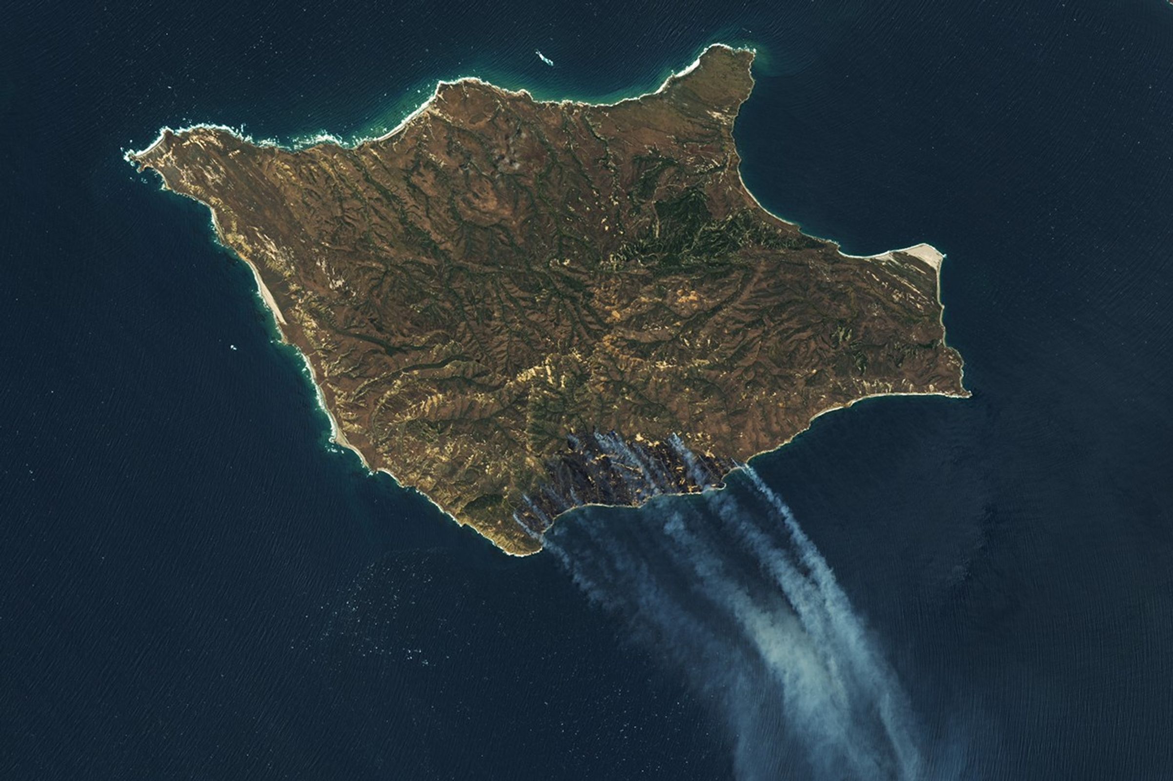
False Color
Natural Color
Channel Islands National Park, a chain of five ecologically rich islands off the coast of mainland California, is known for its diversity of plant and animal species, earning it the nickname “North America’s Galapagos.” For part of May 2026, Santa Rosa Island—the park’s second-largest island—was closed to the public as firefighters worked to contain a wildland fire burning through grassland, coastal sage scrub, and areas of island chaparral.
The fire was first spotted from aircraft on May 15, 2026, and confirmed by the National Park Service that morning. The Landsat 9 satellite captured these images the next day, when the burned area had grown to 5,690 acres (2,300 hectares). By May 19, it had burned around 16,600 acres (6,700 hectares), including much of the southeastern quadrant of the island. Its perimeter remained uncontained.
The left image is false color, composed of wavelengths that cut through the smoke to reveal the burned area (dark brown). The infrared signature of the actively burning fire front is orange. The second image, on the right, shows the same area in natural color, as human eyes would see it, with smoke pouring over the Pacific Ocean.
Officials and news accounts said the fire was human-caused, though investigators were still working to determine the circumstances surrounding the event. According to news reports, the fire burned near a stand of Torrey pines, a rare type of pine that in the United States grows naturally only on Santa Rosa Island and near San Diego.
NASA Earth Observatory images by Lauren Dauphin, using Landsat data from the U.S. Geological Survey. Story by Kathryn Hansen.

References & Resources
- InciWeb (2026, May 19) Santa Rosa Island Fire. Accessed May 19, 2026.
- NASA Earth Observatory (2025, April 21) North America’s “Galapagos.” Accessed May 19, 2026.
- National Park Service, Channel Islands. Accessed May 19, 2026.
- The New York Times (2026, May 18) A Sailor Shot Distress Flares. Now a California Island Is Burning. Accessed May 19, 2026.
You may also be interested in:
Stay up-to-date with the latest content from NASA as we explore the universe and discover more about our home planet.

The National fire has burned tens of thousands of acres within the Florida preserve, fueled by vegetation dried by prolonged…

Beaver Island is one in a string of verdant and scenic jewels in a northern Lake Michigan archipelago.

Dry, warm, and windy conditions across the U.S. Great Plains led to extreme fire activity in March 2026.