


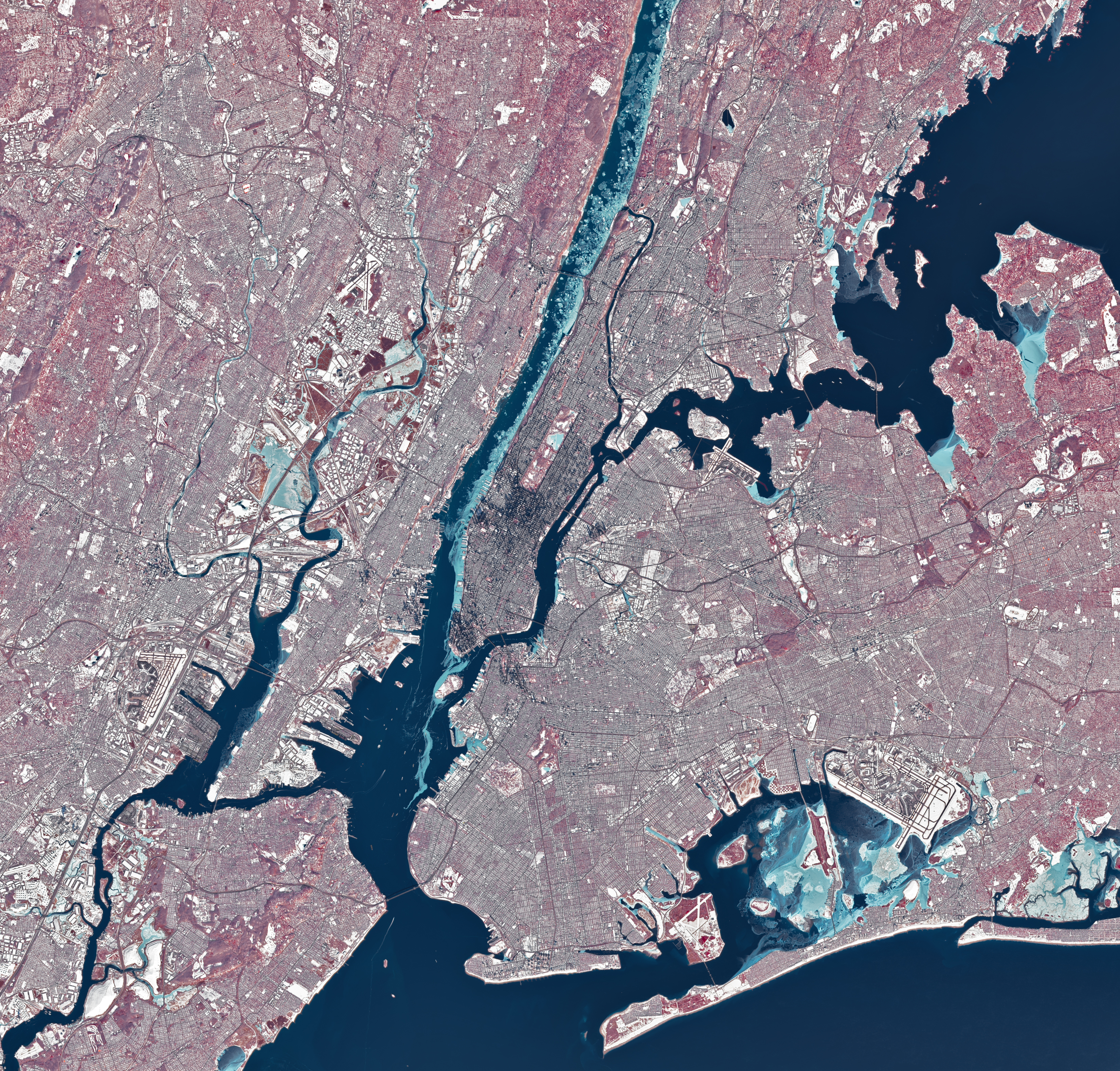
During a stretch of frigid weather in late January 2026, ice choked the Hudson River along Manhattan’s western shore. The OLI (Operational Land Imager) on Landsat 8 captured this image of the wintry landscape around midday on Jan. 28. This image uses representational color to distinguish ice (light blue) from open water and snow. Vegetation appears red.
Much of the ice in the image likely floated there from farther upriver, where tidal currents are weaker and salinity is lower. These conditions allow water to freeze sooner and at higher temperatures than the faster-flowing, brackish water near the river’s mouth, shown here.
Read more about the effects of river ice and how scientists track waterways.
Text credit: Lindsey Doermann
Image credit: Michala Garrison, using Landsat data from the U.S. Geological Survey