






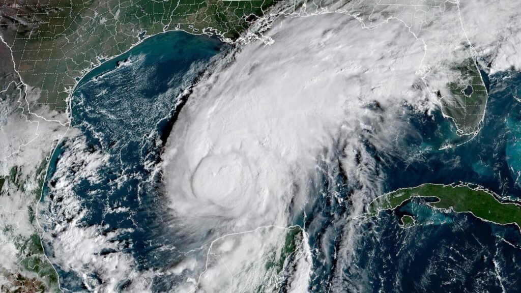
The Gulf Coast is on high alert as Isaias strengthened into a hurricane late Wednesday as it continued moving north and is expected to make landfall in the Florida Panhandle on Friday night.
The National Hurricane Center confirmed late Wednesday night that Isaias had strengthened into a Category 1 storm with maximum sustained winds of 75 mph.
That makes it the first Atlantic hurricane of the season, the latest first hurricane on record.
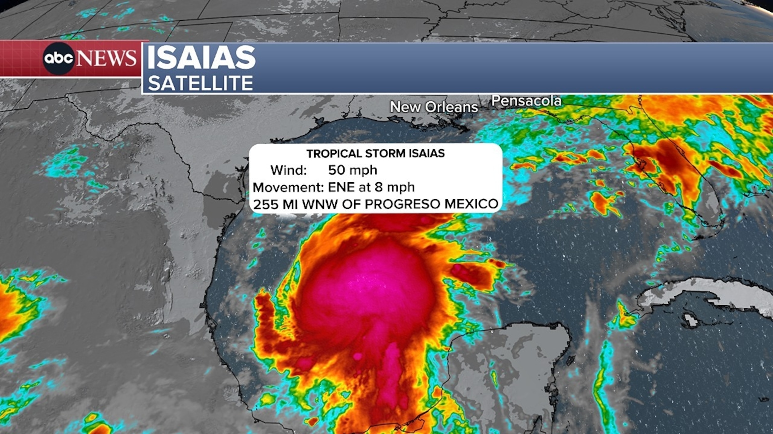
As of Thursday morning, the storm was about 350 miles south of the U.S. Gulf Coast.
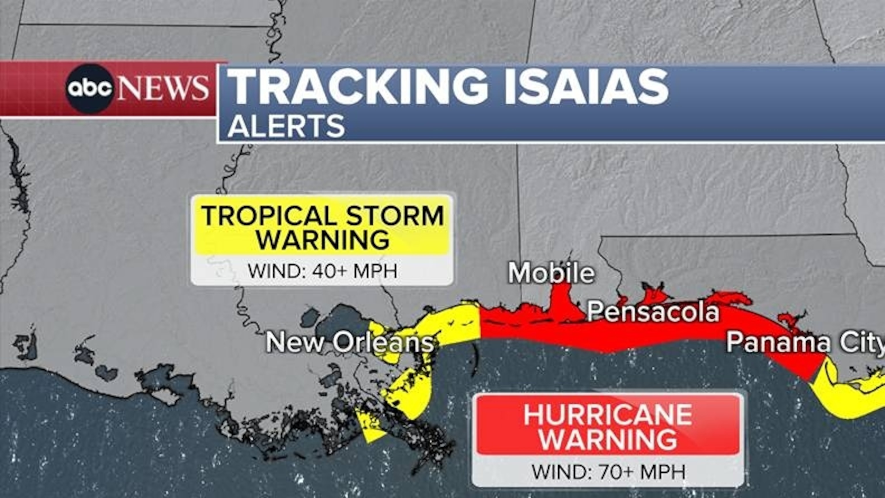
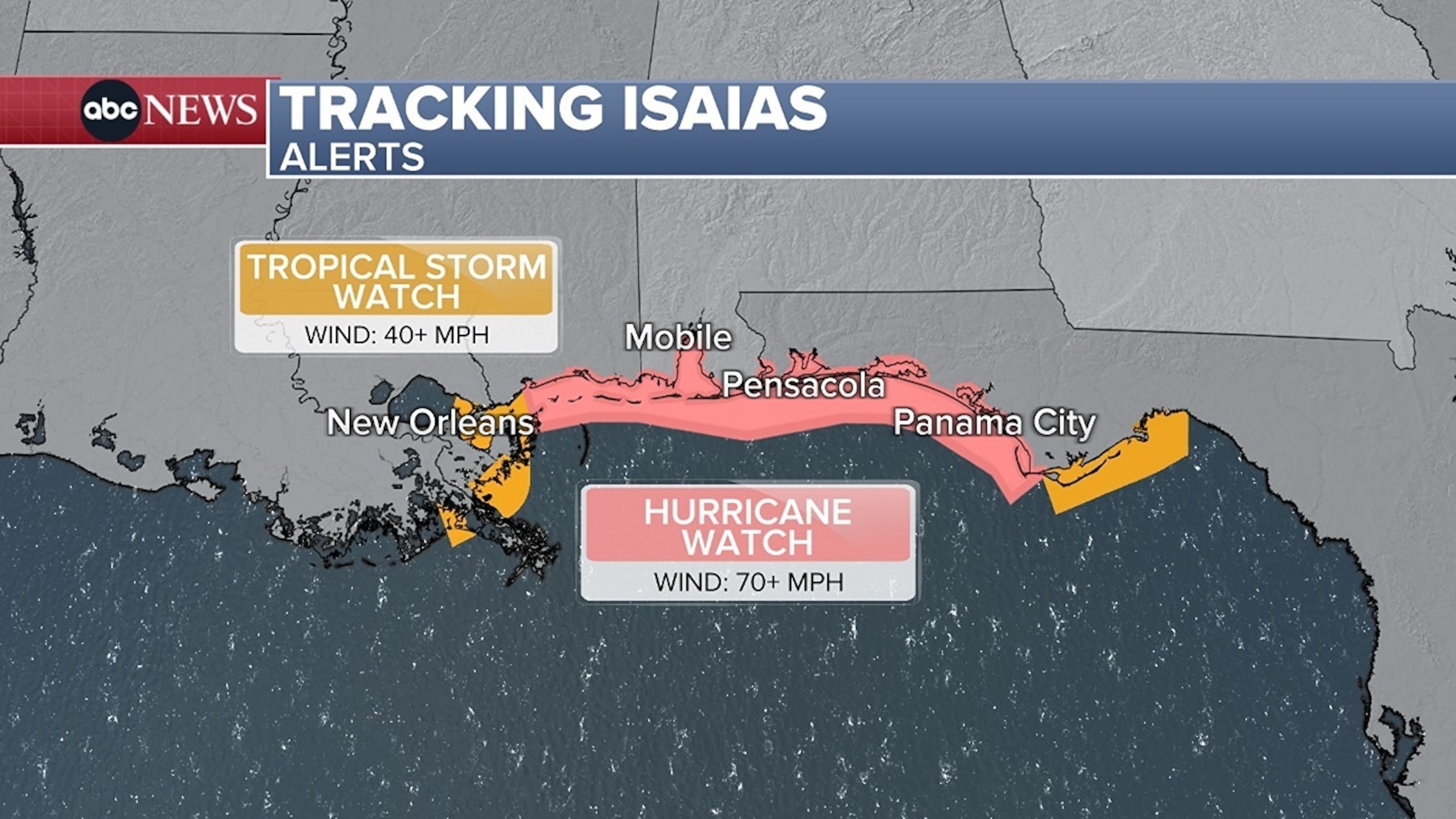
Hurricane and storm surge warnings are in effect for parts of the northern Gulf Coast.
A previously issued hurricane watch was upgraded to a hurricane warning from Ocean Springs, Mississippi, to the Bay-Gulf County Line in Florida.
Wind gusts are 85 miles per hour as of Thursday morning.
Florida issued a state of emergency order Tuesday evening for 25 counties and on Wednesday, Alabama issued one for 40 counties.
“This will allow us to take any needed steps ahead of landfall. As we approach the weekend and any travel plans, make sure you have reliable information as conditions develop,” Alabama Gov. Kay Ivey said in a statement.
The latest forecast shows the storm shifting a bit more east with a landfall closer to Pensacola late Friday night.
The storm is expected to make landfall likely as a Category 1 hurricane.
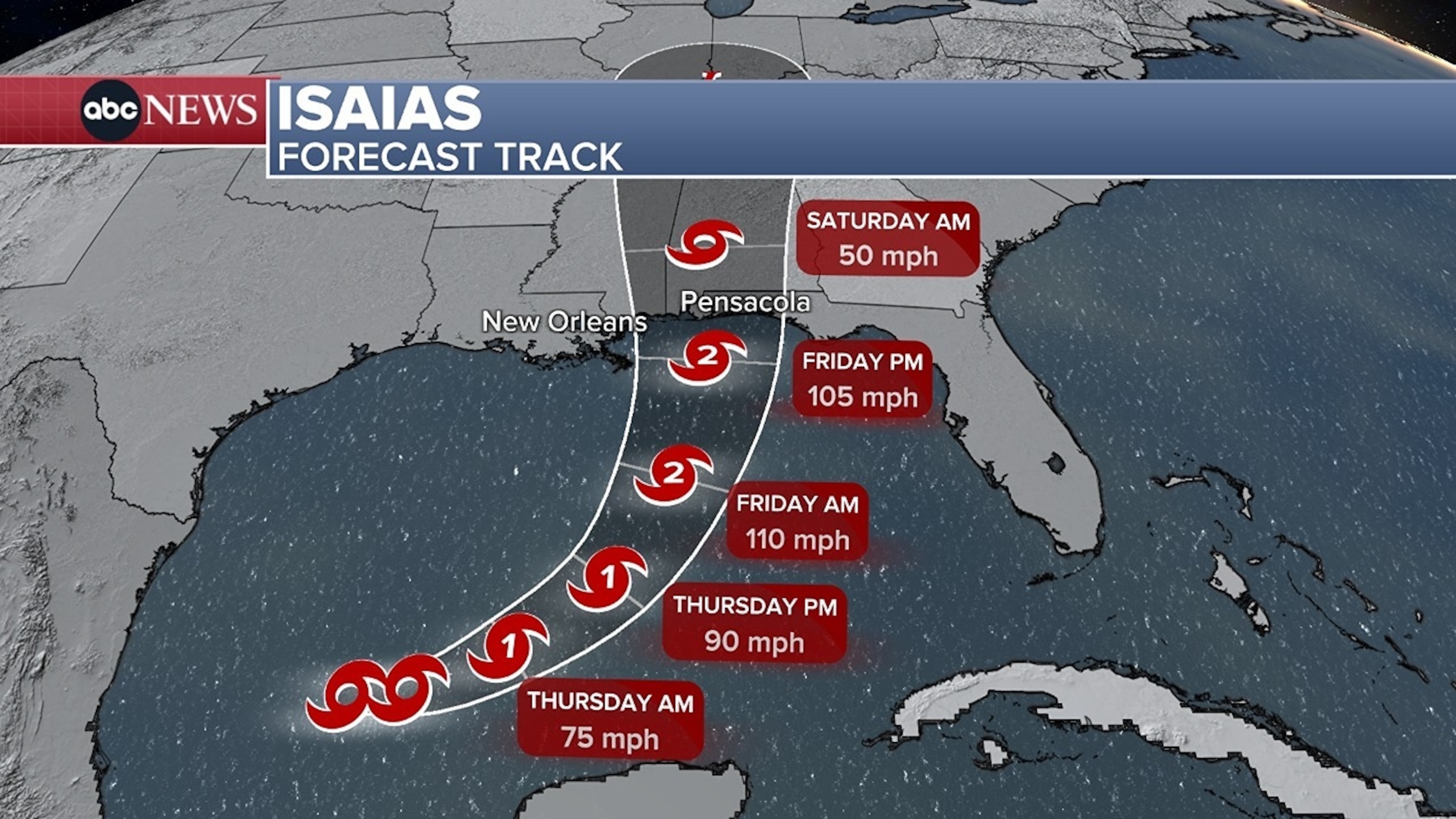
Rain from Isaias may reach the New Orleans to Pensacola region along the Gulf Coast on Friday morning, bringing potentially tropical storm-force winds.
From Friday through the weekend, Isaias is expected to produce 3 to 7 inches of rain across the central U.S. Gulf Coast, with localized totals of up to 15 inches.
Large, dangerous waves are expected to accompany the surges along the coast near and east of the storm’s landfall location.
Storm surges could reach 7 feet in parts of the Mississippi and Alabama coasts, and up to 5 feet on the western Florida panhandle.
Storm surge warnings are in effect from the mouth of the Mississippi River to the to the Steinhatchee River in Florida.
Isaias will be weakening and become a rainmaker on Saturday across the South – especially for inland portions of Mississippi and Alabama.
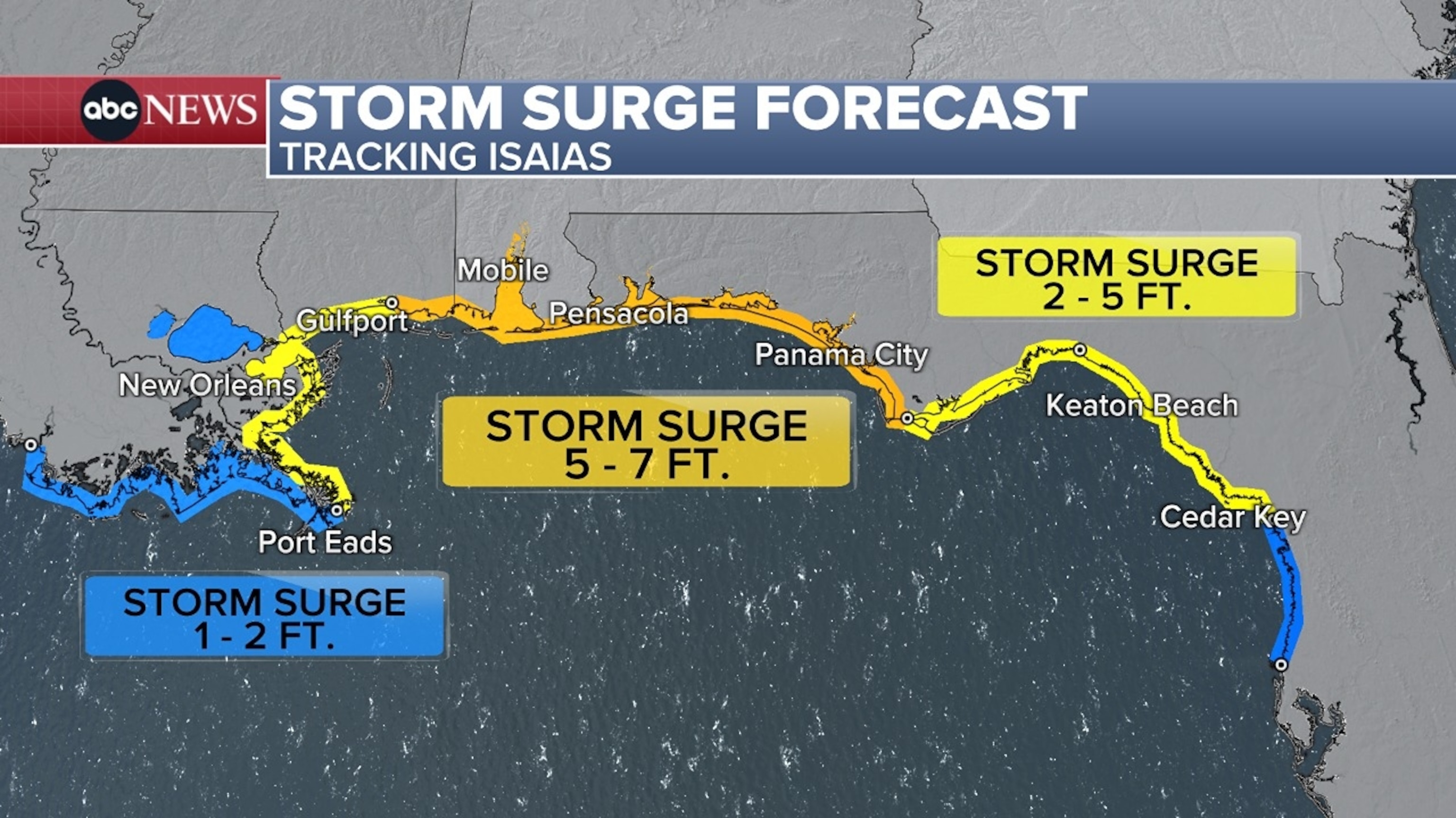
Flooding from the surge can vary greatly over short distances depending on the timing of the surge and tidal cycle.