




When hurricane forecasters released their seasonal outlooks in spring 2026, the El Niño brewing in the Pacific contributed to predictions of below-normal activity in the Atlantic basin but above-normal activity in the northeastern and central Pacific basins. In early September, near the climatological peak of hurricane season, those spring outlooks were on target, with the eastern Pacific buzzing with activity and the Atlantic notably quiet.
As of September 3, the Northeast Pacific had produced 15 named storms and six hurricanes, well above the norm for that point in the season. The Atlantic basin, meanwhile, laboring under unfavorable wind shear conditions, had produced just five named storms and no hurricanes. El Niño typically enhances hurricane activity in the eastern and central Pacific basins because of the unusually warm water temperatures it brings to those parts of the ocean. It tends to suppress hurricane activity in the Atlantic basin by shifting large-scale circulation patterns in a way that makes it harder to sustain storms there.
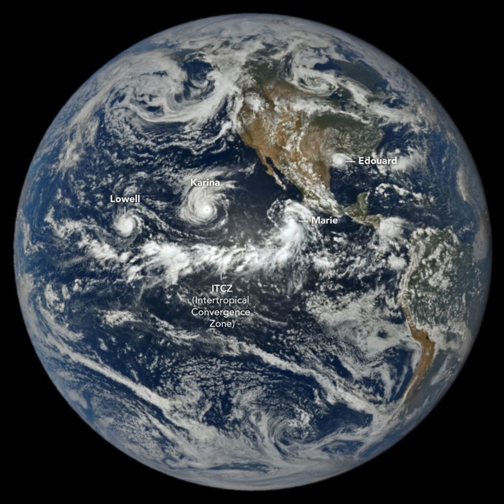
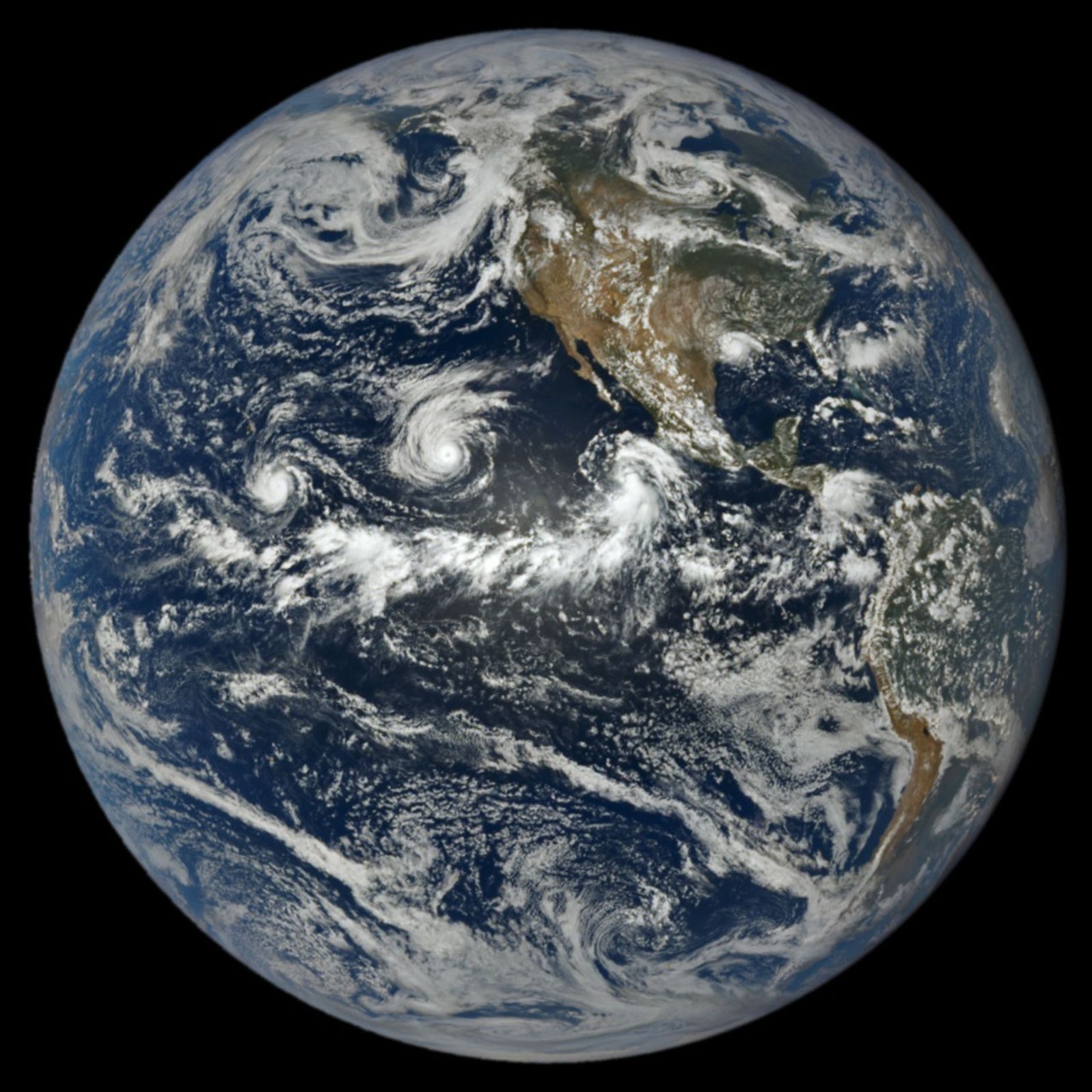
At 1:14 p.m. Pacific Daylight Time (20:14 Universal Time) on September 1, NASA’s EPIC (Earth Polychromatic Imaging Camera) on the DSCOVR (Deep Space Climate Observatory) satellite captured an image of three tropical cyclones churning simultaneously in the Pacific, along with one in the Atlantic. A band of clouds and thunderstorms associated with the Intertropical Convergence Zone (ITCZ) is visible to the south of the storms. The spacecraft was nearly 1 million miles from Earth and just shy of 93 million miles from the Sun when the image was acquired.
The trio of storms in the Pacific were Lowell, Karina, and Marie. Of the three, Lowell became the strongest, with winds reaching category 5 strength for several hours on September 2. Around the same time, Karina, spinning a few thousand kilometers to the east, achieved category 4 strength, a rare case of category 4 and 5 hurricanes occurring simultaneously in the area. Marie, spinning southwest of Baja California, was still a tropical storm when the image was acquired but was strengthening as it moved northwest.
In the Atlantic, Tropical Storm Edouard was visible to EPIC over Louisiana and Texas, shortly after the short-lived storm made landfall. It brought torrential rains and strong winds that downed trees and power lines. Some areas received 15 to 24 inches (38 to 61 centimeters) of rain, according to National Weather Service meteorologists.
As of September 3, the Atlantic basin’s total accumulated cyclone energy (ACE) index was 4.4, about 9 percent of normal for that date, according to statistics compiled by Colorado State University meteorologists. Meanwhile, the Northeast Pacific basin’s ACE was 130, about 50 percent above normal. The ACE index incorporates both the intensity and longevity of storms, making it easier to compare individual storms and seasons.
Several NASA Earth-observing platforms provide data that can aid in emergency preparedness before landfall and damage assessment and response afterward. Use the “Events” tab on NASA’s Worldview browser to track current hurricanes and explore related NASA data products.
NASA Earth Observatory image by Lauren Dauphin, using data from DSCOVR EPIC. Story by Adam Voiland.
References & Resources
- AccuWeather (2023, June 6) Experts say this metric is a more reliable way to quantify the true strength of hurricane season. Accessed September 3, 2026.
- Colorado State University (2026, September 3) Northern Hemisphere Tropical Cyclone Activity for 2026. Accessed September 3, 2026.
- NASA Earthdata, Hurricanes. Accessed September 3, 2026.
- NASA, El Niño. Accessed September 3, 2026.
- NASA Space Place (2025, April 3) How Do Hurricanes Form? Accessed September 3, 2026.
- National Hurricane Center (2026, September 3) Top News of the Day. Accessed September 3, 2026
- Newsweek (2026, September 2) El Niño is Reshaping this Year’s Hurricane Season. Accessed September 3, 2026.
- NOAA (2026, June 2) How does El Niño Impact Atlantic Hurricane Season. Accessed September 3, 2026.
- NOAA (2026, May 21) NOAA 2026 Eastern Pacific Hurricane Season Outlook. Accessed September 3, 2026.
- Yale Climate Connections (2026, September 2) Edouard delivers an outsized flash-flood punch to eastern Texas. Accessed September 3, 2026.
You may also be interested in:
Stay up-to-date with the latest content from NASA as we explore the universe and discover more about our home planet.

The powerful storm delivered extreme rainfall and damaging winds to the state, passing the Island of Hawaiʻi as a category…

The first named storm of the 2026 Atlantic hurricane season brought intense rainfall and the threat of flash flooding to…
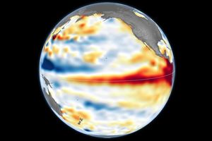
Satellite observations of sea surface height indicated that the 2026 event continued to strengthen in early June.